Geolocate

Aripuanã topographic map

Click on the map to display elevation.

Aripuanã

Localiza-se a uma latitude 10º10'00" sul e a uma longitude 59º27'34" oeste, dentro da Amazônia, estando a uma altitude de 105 metros. Sua população estimada no ano de 2004 era de 17 759 habitantes.

About this map
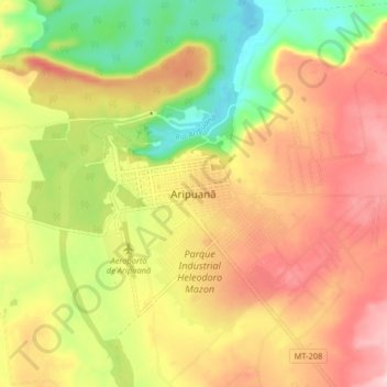
Name: Aripuanã topographic map, elevation, terrain.

Location: Aripuanã, Região Geográfica Imediata de Juína, Região Geográfica Intermediária de Sinop, Mato Grosso, Região Centro-Oeste, Brasil (-10.21581 -59.48397 -10.13581 -59.40397)

Average elevation: 232 m

Minimum elevation: 107 m

Maximum elevation: 344 m

Gear up for your next adventure:

🥾Trail Running Shoes - Lightweight and durable shoes for trail running
🔨Vehicle Emergency Tool - Safety tool for remote road trips to trailheads
🎒Hiking Daypack - Lightweight and durable backpacks for day trips and excursions
🧥Thermal Fleece Jacket - Versatile insulation for changing mountain temperatures
🥾Light Hiking Boots - Lightweight and comfortable boots for day hikes

As an Amazon Associate, this site earns from qualifying purchases at no extra cost to you.