
Make a donation
Gear up for your next adventure:
As an Amazon Associate, this site earns from qualifying purchases at no extra cost to you.
Alvarado topographic map
Click on the map to display elevation.
Make a donation
Gear up for your next adventure:
As an Amazon Associate, this site earns from qualifying purchases at no extra cost to you.
About this map
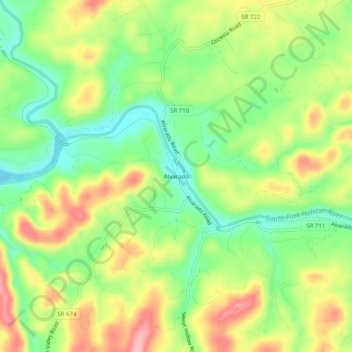
Name: Alvarado topographic map, elevation, terrain.
Location: Alvarado, Washington County, Virginia, United States (36.63067 -81.90679 36.67067 -81.86679)
Average elevation: 580 m
Minimum elevation: 520 m
Maximum elevation: 654 m
Make a donation
Gear up for your next adventure:
As an Amazon Associate, this site earns from qualifying purchases at no extra cost to you.
Other topographic maps
Click on a map to view its topography, its elevation and its terrain.
Clinch Mountain
United States > Virginia > Washington County
For its entire length, Clinch Mountain has only one true gap through which the ridge is completely sliced in half and continues as Clinch Mountain on either side, divided by Big Moccasin Creek. It is named Moccasin Gap and runs between Weber City and Gate City, Virginia. The Norfolk Southern Railway and U.S.…
Average elevation: 618 m
Make a donation
Gear up for your next adventure:
As an Amazon Associate, this site earns from qualifying purchases at no extra cost to you.