
Thank you for supporting this site ❤️
Make a donation
Make a donation
Gear up for your next adventure:
As an Amazon Associate, this site earns from qualifying purchases at no extra cost to you.
Orjais topographic map
Click on the map to display elevation.
Thank you for supporting this site ❤️
Make a donation
Make a donation
Gear up for your next adventure:
As an Amazon Associate, this site earns from qualifying purchases at no extra cost to you.
About this map
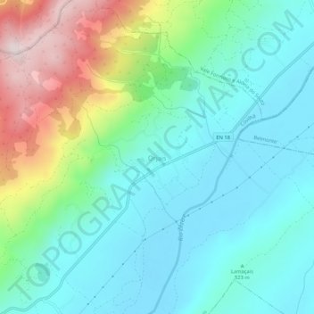
Name: Orjais topographic map, elevation, terrain.
Location: Orjais, Castelo Branco, Centro, 6250-909, Portugal (40.32076 -7.42649 40.36076 -7.38649)
Average elevation: 585 m
Minimum elevation: 435 m
Maximum elevation: 1,005 m
Thank you for supporting this site ❤️
Make a donation
Make a donation
Gear up for your next adventure:
As an Amazon Associate, this site earns from qualifying purchases at no extra cost to you.