
Thank you for supporting this site ❤️
Make a donation
Make a donation
Gear up for your next adventure:
As an Amazon Associate, this site earns from qualifying purchases at no extra cost to you.
Cassimoreno topographic map
Click on the map to display elevation.
Thank you for supporting this site ❤️
Make a donation
Make a donation
Gear up for your next adventure:
As an Amazon Associate, this site earns from qualifying purchases at no extra cost to you.
About this map
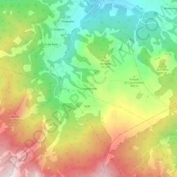
Name: Cassimoreno topographic map, elevation, terrain.
Location: Cassimoreno, Ferriere, Piacenza, Emilia-Romagna, Italia (44.61479 9.55712 44.65479 9.59712)
Average elevation: 908 m
Minimum elevation: 539 m
Maximum elevation: 1,369 m
Thank you for supporting this site ❤️
Make a donation
Make a donation
Gear up for your next adventure:
As an Amazon Associate, this site earns from qualifying purchases at no extra cost to you.