
Thank you for supporting this site ❤️
Make a donation
Make a donation
Gear up for your next adventure:
As an Amazon Associate, this site earns from qualifying purchases at no extra cost to you.
Najurieta topographic map
Click on the map to display elevation.
Thank you for supporting this site ❤️
Make a donation
Make a donation
Gear up for your next adventure:
As an Amazon Associate, this site earns from qualifying purchases at no extra cost to you.
About this map
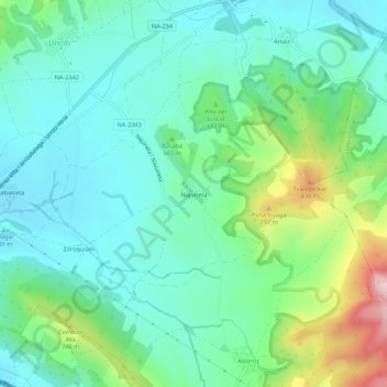
Name: Najurieta topographic map, elevation, terrain.
Location: Najurieta, Unciti, Prepirineo, 31472, España (42.71188 -1.50297 42.75188 -1.46297)
Average elevation: 634 m
Minimum elevation: 534 m
Maximum elevation: 932 m
Thank you for supporting this site ❤️
Make a donation
Make a donation
Gear up for your next adventure:
As an Amazon Associate, this site earns from qualifying purchases at no extra cost to you.