Geolocate

Romillín topographic map

Click on the map to display elevation.

About this map

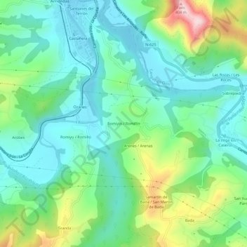
Name: Romillín topographic map, elevation, terrain.

Location: Romillín, Arriondas, Parres, 33540, España (43.34701 -5.19419 43.38701 -5.15419)

Average elevation: 126 m

Minimum elevation: 24 m

Maximum elevation: 394 m

Gear up for your next adventure:

💧Hydration Pack - Hands-free hydration system for long hikes
🥾All-Terrain Hiking Boots - Versatile boots for varied hiking conditions
💡Compact LED Flashlight - Powerful and portable flashlight for outdoor use
🧦Outdoor Socks - Durable socks designed for hiking and outdoor sports
🏃Hydration Running Vest - Carry water and maps close to your body for speed

As an Amazon Associate, this site earns from qualifying purchases at no extra cost to you.