
Thank you for supporting this site ❤️
Make a donation
Make a donation
Gear up for your next adventure:
As an Amazon Associate, this site earns from qualifying purchases at no extra cost to you.
Kavar topographic map
Click on the map to display elevation.
Thank you for supporting this site ❤️
Make a donation
Make a donation
Gear up for your next adventure:
As an Amazon Associate, this site earns from qualifying purchases at no extra cost to you.
About this map
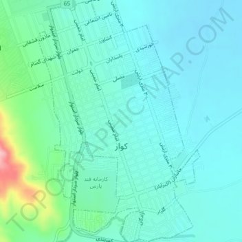
Name: Kavar topographic map, elevation, terrain.
Location: Kavar, بخش مرکزی, Kavar County, Fars Province, Iran (29.18751 52.67994 29.21956 52.70451)
Average elevation: 1,556 m
Minimum elevation: 1,526 m
Maximum elevation: 1,690 m
Thank you for supporting this site ❤️
Make a donation
Make a donation
Gear up for your next adventure:
As an Amazon Associate, this site earns from qualifying purchases at no extra cost to you.