Geolocate

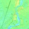
San Roque topographic map

Click on the map to display elevation.

About this map

Name: San Roque topographic map, elevation, terrain.

Location: San Roque, Baliwag, Bulacan, Central Luzon, Philippines (14.98958 120.87681 15.00720 120.89628)

Average elevation: 12 m

Minimum elevation: 9 m

Maximum elevation: 15 m

Other topographic maps

Click on a map to view its topography, its elevation and its terrain.

Tibag

Philippines > Bulacan > Baliwag

Average elevation: 16 m

Santo Niño

Philippines > Bulacan > Baliwag

Average elevation: 14 m

Makinabang

Philippines > Bulacan > Baliwag

Average elevation: 13 m

Tarcan

Philippines > Bulacan > Baliwag

Average elevation: 14 m

Piel

Philippines > Bulacan > Baliwag

Average elevation: 13 m

Sitio Tumana

Philippines > Bulacan > Baliwag > Tibag

Average elevation: 16 m

Catulinan

Philippines > Bulacan > Baliwag

Average elevation: 14 m

Tilapayong

Philippines > Bulacan > Baliwag

Average elevation: 13 m

Matangtubig

Philippines > Bulacan > Baliwag

Average elevation: 12 m

Tibag

Philippines > Bulacan > Baliwag

Average elevation: 16 m

Gear up for your next adventure:

🧢Hiking Hat - Sun-protective and breathable hats for long treks
🧥Softshell Jacket - Windproof and breathable jacket for hiking
🔦LED Headtorch - Bright and durable light for night activities
🥾Light Trekking Boots - Supportive boots for multi-day treks
🧥Ultralight Puffy Jacket - Maximum warmth that packs down to the size of an orange

As an Amazon Associate, this site earns from qualifying purchases at no extra cost to you.