Geolocate

Pingkian topographic map

Click on the map to display elevation.

About this map

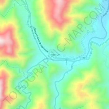
Name: Pingkian topographic map, elevation, terrain.

Location: Pingkian, Nueva Vizcaya, Cagayan Valley, Philippines (16.29074 120.92725 16.33074 120.96725)

Average elevation: 701 m

Minimum elevation: 471 m

Maximum elevation: 1,124 m

Other topographic maps

Click on a map to view its topography, its elevation and its terrain.

Kayapa

Philippines > Nueva Vizcaya

Average elevation: 1,258 m

Kasibu River

Philippines > Nueva Vizcaya > Kasibu

Average elevation: 866 m

Gear up for your next adventure:

💡Solar Camping Lamp - Eco-friendly lighting for campsites
🥾Hiking Shoes - Durable and comfortable shoes for trail hiking
🧥Thermal Layer - Insulating layer for cold outdoor conditions
Backpacking Tent - Lightweight tent for long-distance hiking trips
🥾Mountaineering Boots - Supportive boots for climbing and high-altitude hiking

As an Amazon Associate, this site earns from qualifying purchases at no extra cost to you.