
Thank you for supporting this site ❤️
Make a donation
Make a donation
Gear up for your next adventure:
As an Amazon Associate, this site earns from qualifying purchases at no extra cost to you.
Bas-Rhin topographic map
Click on the map to display elevation.
Thank you for supporting this site ❤️
Make a donation
Make a donation
Gear up for your next adventure:
As an Amazon Associate, this site earns from qualifying purchases at no extra cost to you.
About this map
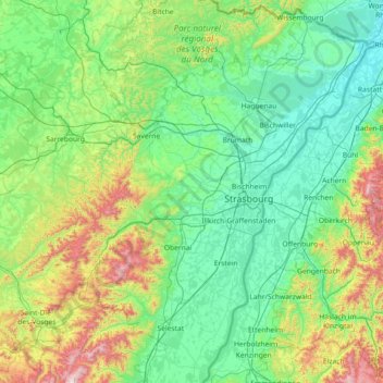
Name: Bas-Rhin topographic map, elevation, terrain.
Location: Bas-Rhin, Grand Est, Metropolitan France, France (48.12043 6.94063 49.07779 8.23285)
Average elevation: 315 m
Minimum elevation: 104 m
Maximum elevation: 1,274 m
Thank you for supporting this site ❤️
Make a donation
Make a donation
Gear up for your next adventure:
As an Amazon Associate, this site earns from qualifying purchases at no extra cost to you.