
Culemborg topographic map
Click on the map to display elevation.
Culemborg
Dutch topographic map of the municipality of Culemborg, June 2015
About this map
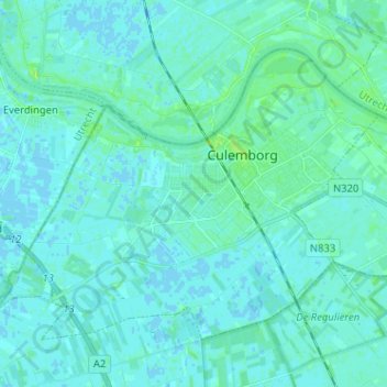
Name: Culemborg topographic map, elevation, terrain.
Location: Culemborg, Gelderland, Netherlands (51.91963 5.14243 51.97894 5.27037)
Average elevation: 2 m
Minimum elevation: -2 m
Maximum elevation: 13 m
Other topographic maps
Click on a map to view its topography, its elevation and its terrain.