Geolocate

Volpara topographic map

Click on the map to display elevation.

About this map

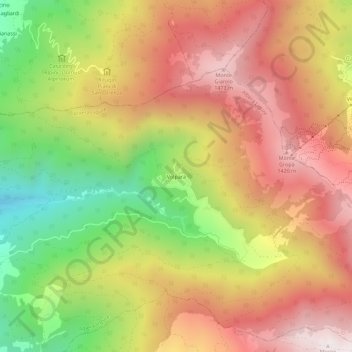
Name: Volpara topographic map, elevation, terrain.

Location: Volpara, Albera Ligure, Alessandria, Piemonte, 15054, Italia (44.69473 9.10100 44.73473 9.14100)

Average elevation: 1,081 m

Minimum elevation: 543 m

Maximum elevation: 1,525 m

Gear up for your next adventure:

🕶️Polarized Sunglasses - Reduces glare from snow and water at high elevations
Camping Coffee Maker - Brew fresh coffee anywhere on the topographic map
🥾Trekking Boots - Durable boots for long-distance trekking
💡Portable Camping Lamp - Rechargeable lamp for campsite lighting
🥾Light Trekking Boots - Supportive boots for multi-day treks

As an Amazon Associate, this site earns from qualifying purchases at no extra cost to you.