
Thank you for supporting this site ❤️
Make a donation
Make a donation
Gear up for your next adventure:
As an Amazon Associate, this site earns from qualifying purchases at no extra cost to you.
Sembungan topographic map
Click on the map to display elevation.
Thank you for supporting this site ❤️
Make a donation
Make a donation
Gear up for your next adventure:
As an Amazon Associate, this site earns from qualifying purchases at no extra cost to you.
About this map
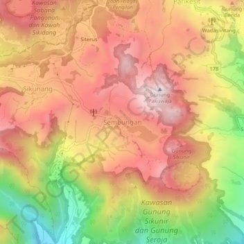
Name: Sembungan topographic map, elevation, terrain.
Location: Sembungan, Wonosobo, Central Java, Java, Indonesia (-7.25450 109.89631 -7.21450 109.93631)
Average elevation: 1,997 m
Minimum elevation: 1,455 m
Maximum elevation: 2,370 m
Thank you for supporting this site ❤️
Make a donation
Make a donation
Gear up for your next adventure:
As an Amazon Associate, this site earns from qualifying purchases at no extra cost to you.