Geolocate

Teevre topographic map

Click on the map to display elevation.

About this map

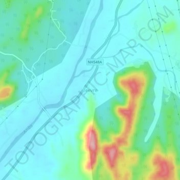
Name: Teevre topographic map, elevation, terrain.

Location: Teevre, Sudhagad Taluka, Raigad, Maharashtra, India (18.58147 73.25308 18.62147 73.29308)

Average elevation: 51 m

Minimum elevation: 15 m

Maximum elevation: 186 m

Gear up for your next adventure:

🥤Collapsible Travel Cup - Saves space and weight in your mess kit
🔭Compact Monocular - One-handed bird watching and trail spotting
🧴Insect Repellent - Protect yourself from bugs during outdoor adventures
🦶Hiking Shoe Insoles - Added support for high arches and long days on feet
🩹Moleskin Blister Pads - Direct protection for painful foot pressure points

As an Amazon Associate, this site earns from qualifying purchases at no extra cost to you.