
A Canda topographic map
Interactive map
Click on the map to display elevation.
About this map
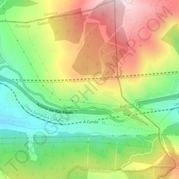
Name: A Canda topographic map, elevation, terrain.
Location: A Canda, A Mezquita, Viana, Orense, Galicia, España (42.02522 -6.99469 42.05516 -6.96175)
Average elevation: 1,309 m
Minimum elevation: 1,027 m
Maximum elevation: 1,648 m
Other topographic maps
Click on a map to view its topography, its elevation and its terrain.
O Pereiro
España > Galicia > Viana > A Mezquita
O Pereiro, A Mezquita, Viana, Orense, Galicia, España
Average elevation: 1,119 m