
Thank you for supporting this site ❤️
Make a donation
Make a donation
Gear up for your next adventure:
As an Amazon Associate, this site earns from qualifying purchases at no extra cost to you.
Soppera topographic map
Click on the map to display elevation.
Thank you for supporting this site ❤️
Make a donation
Make a donation
Gear up for your next adventure:
As an Amazon Associate, this site earns from qualifying purchases at no extra cost to you.
About this map
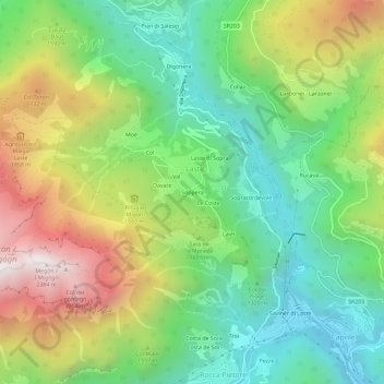
Name: Soppera topographic map, elevation, terrain.
Location: Soppera, Laste, Rocca Pietore, Belluno, Veneto, 32023, Italia (46.43289 11.95251 46.47289 11.99251)
Average elevation: 1,510 m
Minimum elevation: 993 m
Maximum elevation: 2,355 m
Thank you for supporting this site ❤️
Make a donation
Make a donation
Gear up for your next adventure:
As an Amazon Associate, this site earns from qualifying purchases at no extra cost to you.