Geolocate

Lessos topographic map

Click on the map to display elevation.

About this map

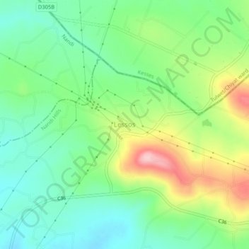
Name: Lessos topographic map, elevation, terrain.

Location: Lessos, Ol'lessos ward, Nandi Hills, Nandi County, Kenya (0.19576 35.28023 0.23576 35.32023)

Average elevation: 2,147 m

Minimum elevation: 2,082 m

Maximum elevation: 2,269 m

Gear up for your next adventure:

🧭Orienteering Kit - Tools for map reading and navigation in the wild
🧥Thermal Layer - Insulating layer for cold outdoor conditions
🥾Approach Boots - Comfortable boots for hiking and climbing approaches
🧳Compression Sacks - Maximize space in your backpack by shrinking gear
🥾Mountaineering Boots - Supportive boots for climbing and high-altitude hiking

As an Amazon Associate, this site earns from qualifying purchases at no extra cost to you.