
Thank you for supporting this site ❤️
Make a donation
Make a donation
Gear up for your next adventure:
As an Amazon Associate, this site earns from qualifying purchases at no extra cost to you.
Shandia topographic map
Click on the map to display elevation.
Thank you for supporting this site ❤️
Make a donation
Make a donation
Gear up for your next adventure:
As an Amazon Associate, this site earns from qualifying purchases at no extra cost to you.
About this map
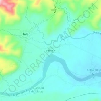
Name: Shandia topographic map, elevation, terrain.
Location: Shandia, Talag, Tálag, Tena, Napo, 150106, Ecuador (-1.09159 -77.91761 -1.05159 -77.87761)
Average elevation: 533 m
Minimum elevation: 480 m
Maximum elevation: 734 m
Thank you for supporting this site ❤️
Make a donation
Make a donation
Gear up for your next adventure:
As an Amazon Associate, this site earns from qualifying purchases at no extra cost to you.