
Heiligenblut topographic map
Click on the map to display elevation.
About this map
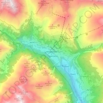
Name: Heiligenblut topographic map, elevation, terrain.
Average elevation: 1,982 m
Minimum elevation: 1,077 m
Maximum elevation: 3,024 m
Other topographic maps
Click on a map to view its topography, its elevation and its terrain.
Pasterze
Austria > Carinthia > Bezirk Spittal an der Drau > Heiligenblut am Großglockner
Average elevation: 2,599 m
High Tauern National Park
Austria > Carinthia > Bezirk Spittal an der Drau > Heiligenblut am Großglockner
Average elevation: 1,710 m