Geolocate

San Agustín topographic map

Click on the map to display elevation.

About this map
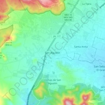
Name: San Agustín topographic map, elevation, terrain.

Location: San Agustín, Tlajomulco de Zúñiga, Región Centro, Jalisco, 45645, Mexico (20.50639 -103.50686 20.58639 -103.42686)

Average elevation: 1,646 m

Minimum elevation: 1,553 m

Maximum elevation: 1,993 m

Other topographic maps

Click on a map to view its topography, its elevation and its terrain.
Gear up for your next adventure:

🕯️Camping Lantern - Illuminates your entire campsite with high-efficiency LEDs
⛺Lightweight Backpacking Tent - Compact tent for efficient hiking trips
🧰Survival Kit - Essential gear for emergencies in the wilderness
🥾Durable Hiking Shoes - Long-lasting shoes for frequent hiking
🌬️Windproof Camp Stove - Efficient cooking even on exposed mountain peaks

As an Amazon Associate, this site earns from qualifying purchases at no extra cost to you.