Geolocate

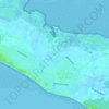
Olivette topographic map

Click on the map to display elevation.

About this map

Name: Olivette topographic map, elevation, terrain.

Location: Olivette, La Couarde-sur-Mer, La Rochelle, Charente-Maritime, Nouvelle-Aquitaine, France métropolitaine, 17670, France (46.17552 -1.44067 46.21552 -1.40067)

Average elevation: 1 m

Minimum elevation: -3 m

Maximum elevation: 12 m

Other topographic maps

Click on a map to view its topography, its elevation and its terrain.
Gear up for your next adventure:

💧Filtered Water Bottle - Safe drinking water on the go
🧭GPS Outdoor Watch - Smart watch for navigation and fitness tracking in nature
🧥Packable Rain Jacket - Breathable waterproof layer for unpredictable weather
🍽️Titanium Camping Spork - Ultralight and indestructible eating utensil
🛶Waterproof Dry Bags - Keep electronics and clothes dry during river crossings

As an Amazon Associate, this site earns from qualifying purchases at no extra cost to you.