Geolocate

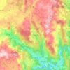
O Gorgal topographic map

Click on the map to display elevation.

About this map

Name: O Gorgal topographic map, elevation, terrain.

Location: O Gorgal, Xallas, Negreira, Barcala, La Coruña, Galicia, 15838, España (42.89798 -8.86758 42.93798 -8.82758)

Average elevation: 407 m

Minimum elevation: 210 m

Maximum elevation: 515 m

Other topographic maps

Click on a map to view its topography, its elevation and its terrain.

Negreira

España > Galicia > Barcala

Average elevation: 266 m

Liñaio

España > Galicia > Barcala

Average elevation: 243 m

A Baña

España > Galicia > Barcala

Average elevation: 321 m

Barcala

España > Galicia > Barcala

Average elevation: 289 m

Broño

España > Galicia > Barcala

Average elevation: 258 m

A Baña

España > Galicia > Barcala

Average elevation: 321 m

Gear up for your next adventure:

🧶550 Survival Paracord - Versatile utility cord for emergency repairs and rigging
🧴Outdoor Sunscreen - High SPF protection for high-altitude UV exposure
⛺Lightweight Backpacking Tent - Compact tent for efficient hiking trips
⛺Camping Essentials - All-in-one gear for a comfortable camping trip
⛺Backpacking Tent - Lightweight tent for long-distance hiking trips

As an Amazon Associate, this site earns from qualifying purchases at no extra cost to you.