Geolocate

Tanjung Puri topographic map

Click on the map to display elevation.

About this map
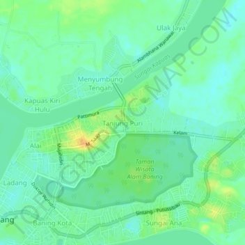
Name: Tanjung Puri topographic map, elevation, terrain.

Location: Tanjung Puri, Sintang, West Kalimantan, 78612, Indonesia (0.05945 111.48663 0.09945 111.52663)

Average elevation: 23 m

Minimum elevation: 13 m

Maximum elevation: 42 m

Other topographic maps

Click on a map to view its topography, its elevation and its terrain.

Sepauk

Indonesia > West Kalimantan > Sintang

Average elevation: 122 m

Kelam Permai

Indonesia > West Kalimantan > Sintang

Average elevation: 46 m

Gear up for your next adventure:

🧊Insulated Water Bottle - Keeps drinks cold in summer and prevents freezing in winter
🥾Trail Running Boots - Durable shoes designed for trail running
🌬️Windproof Camp Stove - Efficient cooking even on exposed mountain peaks
🦟Insect Repellent - Keep mosquitoes and black flies away in wooded areas
🥾Light Trekking Boots - Supportive boots for multi-day treks

As an Amazon Associate, this site earns from qualifying purchases at no extra cost to you.