Geolocate

Sukataris topographic map

Click on the map to display elevation.

About this map
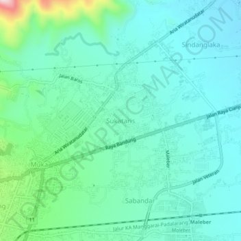
Name: Sukataris topographic map, elevation, terrain.

Location: Sukataris, Cianjur, West Java, 43281, Indonesia (-6.81676 107.14001 -6.77676 107.18001)

Average elevation: 405 m

Minimum elevation: 311 m

Maximum elevation: 874 m

Other topographic maps

Click on a map to view its topography, its elevation and its terrain.

Sindangbarang

Indonesia > West Java > Cianjur

Average elevation: 148 m

Wangunjaya

Indonesia > West Java > Cianjur

Average elevation: 17 m

Kertamukti

Indonesia > West Java > Cianjur

Average elevation: 25 m

Alun Alun Suryakancana

Indonesia > West Java > Cianjur

Average elevation: 2,568 m

Gear up for your next adventure:

👟Trail Running Shoes - Agile footwear for fast-paced topographic exploration
🧭GPS Handheld Device - Reliable GPS navigation for outdoor adventures
🪑Ultralight Camping Stool - Compact seating for rest stops during long hikes
💡LED Headlamp - Hands-free illumination for night hiking and camping
⛺Bushcraft Tarp - Versatile emergency shelter or gear protection

As an Amazon Associate, this site earns from qualifying purchases at no extra cost to you.