Geolocate

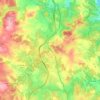
La Croix topographic map

Click on the map to display elevation.

About this map

Name: La Croix topographic map, elevation, terrain.

Location: La Croix, Aumont-Aubrac, Peyre en Aubrac, Mende, Lozère, Occitanie, France métropolitaine, 48130, France (44.69099 3.26714 44.73099 3.30714)

Average elevation: 1,051 m

Minimum elevation: 992 m

Maximum elevation: 1,124 m

Other topographic maps

Click on a map to view its topography, its elevation and its terrain.
Aumont-Aubrac

France > Occitanie > Lozère > Peyre en Aubrac

Average elevation: 1,044 m

La Chaze-de-Peyre

France > Occitanie > Lozère > Peyre en Aubrac

Average elevation: 1,071 m

Javols

France > Occitanie > Lozère > Peyre en Aubrac

Average elevation: 1,039 m

Fau-de-Peyre

France > Occitanie > Lozère > Peyre en Aubrac

Average elevation: 1,139 m

Fau-de-Peyre

France > Occitanie > Lozère > Peyre en Aubrac

Average elevation: 1,139 m

Aumont-Aubrac

France > Occitanie > Lozère > Peyre en Aubrac

Average elevation: 1,044 m

Gear up for your next adventure:

💧Collapsible Water Bottle - Space-saving water bottle for outdoor activities
🔨Vehicle Emergency Tool - Safety tool for remote road trips to trailheads
🔥Camping Stove - Portable stoves to cook outdoors with ease
⛺Backpacking Tent - Lightweight tent for long-distance hiking trips
🧤Rechargeable Heated Gloves - Extreme warmth for Canadian winter expeditions

As an Amazon Associate, this site earns from qualifying purchases at no extra cost to you.