Geolocate

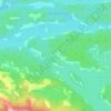
Bell Lake topographic map

Click on the map to display elevation.

About this map

Name: Bell Lake topographic map, elevation, terrain.

Location: Bell Lake, Killarney, Sudbury District, Northeastern Ontario, Ontario, Canada (46.12115 -81.24803 46.16263 -81.17568)

Average elevation: 237 m

Minimum elevation: 204 m

Maximum elevation: 281 m

Sudbury District trails, hiking, mountain biking, running and outdoor activities

Other topographic maps

Click on a map to view its topography, its elevation and its terrain.
Eagles Nest

Canada > Ontario > Sudbury District > Killarney

Average elevation: 191 m

Anchor Island

Canada > Ontario > Sudbury District > Killarney

Average elevation: 203 m

Gear up for your next adventure:

🔋Emergency Crank Radio - Weather alerts and power without needing batteries
💡Portable Camping Lamp - Rechargeable lamp for campsite lighting
⛺Lightweight Camping Tent - Portable shelter optimized for Canadian backcountry camping
🚲Bike Repair Kit - Essential tools for on-trail mechanical issues
🧥Thermal Fleece Jacket - Versatile insulation for changing mountain temperatures

As an Amazon Associate, this site earns from qualifying purchases at no extra cost to you.