Geolocate

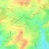
18230 topographic map

Click on the map to display elevation.

About this map

Name: 18230 topographic map, elevation, terrain.

Location: 18230, Saint-Doulchard, Bourges, Cher, Centre-Val de Loire, France métropolitaine, France (47.08459 2.31799 47.13860 2.39291)

Average elevation: 142 m

Minimum elevation: 118 m

Maximum elevation: 169 m

Other topographic maps

Click on a map to view its topography, its elevation and its terrain.
Le Briou

France > Centre-Val de Loire > Cher > Saint-Doulchard

Average elevation: 151 m

Gear up for your next adventure:

🧼Travel Hand Sanitizer - Keep hands clean when water is scarce
🦯Trekking Poles - Reduced impact on joints for steep topographic climbs
🧊Portable Cooler - Keep food and drinks cold during outdoor adventures
🥾Mountain Hiking Shoes - Shoes with superior grip for mountainous terrain
🧦Hiking Liner Socks - Thin base layer to prevent friction and blisters

As an Amazon Associate, this site earns from qualifying purchases at no extra cost to you.