Geolocate

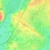
Lac de Maine topographic map

Click on the map to display elevation.

About this map

Name: Lac de Maine topographic map, elevation, terrain.

Location: Lac de Maine, Angers, Maine-et-Loire, Pays de la Loire, France métropolitaine, France (47.45185 -0.61769 47.46958 -0.57450)

Average elevation: 38 m

Minimum elevation: 9 m

Maximum elevation: 70 m

Other topographic maps

Click on a map to view its topography, its elevation and its terrain.
Frémur

France > Pays de la Loire > Maine-et-Loire > Angers

Average elevation: 29 m

Parc Balzac

France > Pays de la Loire > Maine-et-Loire > Angers

Average elevation: 31 m

Parc du Pin

France > Pays de la Loire > Maine-et-Loire > Angers

Average elevation: 39 m

Place Ney

France > Pays de la Loire > Maine-et-Loire > Angers

Average elevation: 36 m

Gear up for your next adventure:

☕Camping Coffee Maker - Brew fresh coffee anywhere on the topographic map
🛶Waterproof Dry Bags - Keep electronics and clothes dry during river crossings
🧳Compression Sacks - Maximize space in your backpack by shrinking gear
🛶Kayak Dry Bag - Waterproof storage for kayaking adventures
🧦Merino Wool Socks - Moisture-wicking comfort for long-distance hiking

As an Amazon Associate, this site earns from qualifying purchases at no extra cost to you.