Geolocate

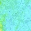
Napindan topographic map

Click on the map to display elevation.

About this map

Name: Napindan topographic map, elevation, terrain.

Location: Napindan, Tipas, Taguig District 1, Taguig, Southern Manila District, Metro Manila, Philippines (14.52456 121.08776 14.54502 121.10845)

Average elevation: 4 m

Minimum elevation: -2 m

Maximum elevation: 10 m

Other topographic maps

Click on a map to view its topography, its elevation and its terrain.
Taguig River

Philippines > Taguig

Average elevation: 6 m

Taguig River

Philippines > Taguig

Average elevation: 5 m

De Jesus Oval

Philippines > Taguig

Average elevation: 25 m

BGC Greenway Park

Philippines > Taguig

Average elevation: 25 m

Tipas River

Philippines > Taguig

Average elevation: 4 m

Taguig River

Philippines > Taguig

Average elevation: 3 m

Daang Manunuso Creek

Philippines > Taguig

Average elevation: 5 m

Gear up for your next adventure:

🥾Trekking Poles - Adjustable trekking poles to reduce knee stress and improve stability
🦶Hiking Shoe Insoles - Added support for high arches and long days on feet
🧦Merino Wool Socks - Moisture-wicking comfort for long-distance hiking
💡LED Camping Lantern - Illuminate your campsite with long-lasting lanterns
🔥Camping Stove - Portable stoves to cook outdoors with ease

As an Amazon Associate, this site earns from qualifying purchases at no extra cost to you.