Geolocate

Port-Joinville topographic map

Click on the map to display elevation.

About this map
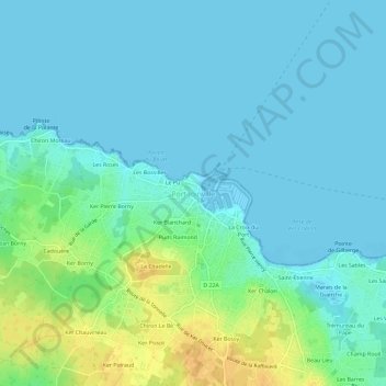
Name: Port-Joinville topographic map, elevation, terrain.

Location: Port-Joinville, L'Île-d'Yeu, Les Sables-d'Olonne, Vendée, Pays de la Loire, Metropolitan France, 85350, France (46.70661 -2.37086 46.74661 -2.33086)

Average elevation: 7 m

Minimum elevation: -1 m

Maximum elevation: 28 m

Other topographic maps

Click on a map to view its topography, its elevation and its terrain.

Île d'Yeu

France > Pays de la Loire > Vendée > L'Île-d'Yeu

Average elevation: 4 m

Gear up for your next adventure:

🥾Lightweight Hiking Shoes - Comfortable shoes for day hikes
🧦Crew Hiking Socks - Comfortable socks for long-distance hikes
🛶Kayak Dry Bag - Waterproof storage for kayaking adventures
🧥Softshell Jacket - Windproof and breathable jacket for hiking
🎒Hiking Daypack - Lightweight and durable backpacks for day trips and excursions

As an Amazon Associate, this site earns from qualifying purchases at no extra cost to you.