Geolocate

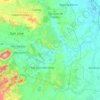
Santa Cruz topographic map

Click on the map to display elevation.

About this map

Name: Santa Cruz topographic map, elevation, terrain.

Location: Santa Cruz, San Jose, Tarlac, Central Luzon, 2318, Philippines (15.45393 120.41385 15.49393 120.45385)

Average elevation: 114 m

Minimum elevation: 83 m

Maximum elevation: 250 m

Other topographic maps

Click on a map to view its topography, its elevation and its terrain.
Bulsa River

Philippines > Tarlac > San Jose

Average elevation: 99 m

Gear up for your next adventure:

🥾Hiking Shorts - Breathable shorts suitable for summer hikes
🧢Beanie Hat - Keep your head warm in cold weather
⛺Bushcraft Tarp - Versatile emergency shelter or gear protection
📷Outdoor Action Camera - Capture high-elevation views and rugged adventures
🌡️Emergency Mylar Blankets - Compact thermal protection for unexpected nights outdoors

As an Amazon Associate, this site earns from qualifying purchases at no extra cost to you.