
Laverlochère topographic map
Interactive map
Click on the map to display elevation.
About this map
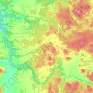
Name: Laverlochère topographic map, elevation, terrain.
Average elevation: 246 m
Minimum elevation: 184 m
Maximum elevation: 320 m
Other topographic maps
Click on a map to view its topography, its elevation and its terrain.
Lac des Quinze
Canada > Québec > Témiscamingue > Laverlochère-Angliers
Lac des Quinze, Laverlochère-Angliers, Témiscamingue, Abitibi-Témiscamingue, Québec, Canada
Average elevation: 276 m
Angliers
Canada > Québec > Témiscamingue > Laverlochère-Angliers > Angliers
Angliers, Laverlochère-Angliers, Témiscamingue, Abitibi-Témiscamingue, Québec, J0Z 1A0, Canada
Average elevation: 268 m