Geolocate

Masella topographic map

Click on the map to display elevation.

About this map
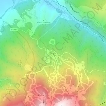
Name: Masella topographic map, elevation, terrain.

Location: Masella, Alp, Cerdaña, Gerona, Cataluña, 17538, España (42.33110 1.88122 42.37110 1.92122)

Average elevation: 1,617 m

Minimum elevation: 1,146 m

Maximum elevation: 2,311 m

Gear up for your next adventure:

🧣Evaporative Cooling Towel - Beat the heat during intense summer climbs
🚑Survival Whistle - Signal for help across long distances in mountains
🌬️Windproof Camp Stove - Efficient cooking even on exposed mountain peaks
🥾Trail Running Shoes - Lightweight and durable shoes for trail running
🔪Outdoor Multitool - Versatile tool for repairs and food prep in the wild

As an Amazon Associate, this site earns from qualifying purchases at no extra cost to you.