
Holstebro topographic map
Interactive map
Click on the map to display elevation.
About this map
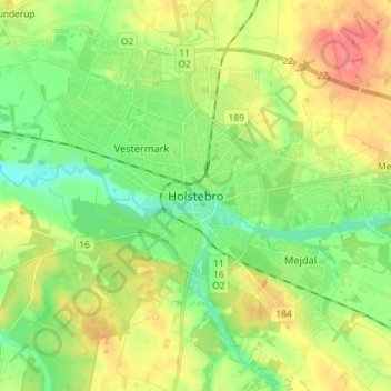
Name: Holstebro topographic map, elevation, terrain.
Location: Holstebro, Holstebro Kommune, Jutland centrale, 7500, Danimarca (56.31903 8.57592 56.39903 8.65592)
Average elevation: 29 m
Minimum elevation: 4 m
Maximum elevation: 64 m