Geolocate

Lindsdal topographic map

Click on the map to display elevation.

About this map

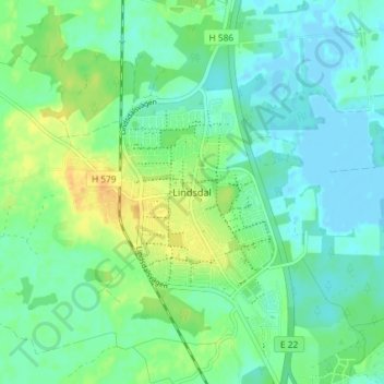
Name: Lindsdal topographic map, elevation, terrain.

Location: Lindsdal, Kalmar kommun, Kalmar County, 393 64, Sweden (56.71393 16.27743 56.75393 16.31743)

Average elevation: 9 m

Minimum elevation: -2 m

Maximum elevation: 26 m

Other topographic maps

Click on a map to view its topography, its elevation and its terrain.

Nybro kommun

Sweden > Kalmar County

Average elevation: 109 m

Emmaboda kommun

Sweden > Kalmar County

Average elevation: 141 m

Hultsfreds kommun

Sweden > Kalmar County

Average elevation: 143 m

Emmaboda kommun

Sweden > Kalmar County

Average elevation: 141 m

Hansa City

Sweden > Kalmar County

Average elevation: 7 m

Högsby kommun

Sweden > Kalmar County

Average elevation: 97 m

Store Hindsjön

Sweden > Kalmar County

Average elevation: 118 m

Mönsterås kommun

Sweden > Kalmar County

Average elevation: 26 m

Alen

Sweden > Kalmar County

Average elevation: 142 m

Oskarshamns kommun

Sweden > Kalmar County

Average elevation: 63 m

Kalmar kommun

Sweden > Kalmar County

Average elevation: 28 m

Gear up for your next adventure:

🥾Approach Shoes - Shoes designed for climbing approaches and rugged trails
🧢Sun Protection Cap - Breathable cap to protect from sun exposure
Camping Essentials - All-in-one gear for a comfortable camping trip
🧣Merino Neck Gaiter - Protects against wind, sun, and cold at high altitudes
👟Sport Hiking Sandals - Breathable footwear for water crossings and camp rest

As an Amazon Associate, this site earns from qualifying purchases at no extra cost to you.