Geolocate

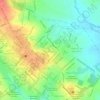
Colônia Treze topographic map

Click on the map to display elevation.

About this map

Name: Colônia Treze topographic map, elevation, terrain.

Location: Colônia Treze, Lagarto, Sergipe, Região Nordeste, 49409-180, Brasil (-11.00603 -37.57054 -10.96603 -37.53054)

Average elevation: 165 m

Minimum elevation: 118 m

Maximum elevation: 181 m

Other topographic maps

Click on a map to view its topography, its elevation and its terrain.

Jardim Campo Novo

Brasil > Sergipe > Lagarto

Average elevation: 145 m

Silvio Romero

Brasil > Sergipe > Lagarto

Average elevation: 161 m

Praça Artur Gomes

Brasil > Sergipe > Lagarto

Average elevation: 167 m

Gear up for your next adventure:

💡LED Headlamp - Hands-free illumination for night hiking and camping
🧭GPS Tracker - Track your location in remote areas safely
🥾Waterproof Hiking Boots - Boots keeping your feet dry in wet conditions
🧰Multitool Knife - Compact and versatile tool for outdoor use
🥤Collapsible Travel Cup - Saves space and weight in your mess kit

As an Amazon Associate, this site earns from qualifying purchases at no extra cost to you.