Geolocate

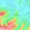
Le Fresne topographic map

Click on the map to display elevation.

About this map

Name: Le Fresne topographic map, elevation, terrain.

Location: Le Fresne, Camelin, Laon, Aisne, Hauts-de-France, France métropolitaine, 02300, France (49.50037 3.11836 49.54037 3.15836)

Average elevation: 86 m

Minimum elevation: 53 m

Maximum elevation: 159 m

Other topographic maps

Click on a map to view its topography, its elevation and its terrain.
Camelin

France > Hauts-de-France > Aisne > Camelin

Average elevation: 83 m

Gear up for your next adventure:

🧦Merino Wool Socks - Moisture-wicking comfort for long-distance hiking
🧊Portable Cooler - Keep food and drinks cold during outdoor adventures
⛺Camping Groundsheet - Protect your tent from moisture and dirt
🗺️Topographic Maps - Detailed maps to explore trails, mountains, and wilderness areas
🥾Trekking Boots - Durable boots for long-distance trekking

As an Amazon Associate, this site earns from qualifying purchases at no extra cost to you.