Geolocate

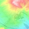
Karaali topographic map

Click on the map to display elevation.

About this map

Name: Karaali topographic map, elevation, terrain.

Location: Karaali, Elâzığ, Elazığ, Eastern Anatolia Region, Turkey (38.54665 38.92331 38.58665 38.96331)

Average elevation: 1,409 m

Minimum elevation: 1,254 m

Maximum elevation: 1,706 m

Other topographic maps

Click on a map to view its topography, its elevation and its terrain.

Lake Hazar

Turkey > Elazığ

Average elevation: 1,340 m

Hilalkent Mahallesi

Turkey > Elazığ

Average elevation: 1,136 m

Çaydaçıra Mahallesi

Turkey > Elazığ

Average elevation: 1,217 m

Gear up for your next adventure:

🧰Emergency Multi-Tool - Compact multi-tool for outdoor survival
🥾Trekking Poles - Adjustable trekking poles to reduce knee stress and improve stability
👖Convertible Hiking Pants - Zip-off legs to adapt to changing weather conditions
🥾Lightweight Hiking Shoes - Comfortable shoes for day hikes
🧣Merino Neck Gaiter - Protects against wind, sun, and cold at high altitudes

As an Amazon Associate, this site earns from qualifying purchases at no extra cost to you.