Geolocate

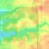
Winnebago topographic map

Click on the map to display elevation.

About this map

Name: Winnebago topographic map, elevation, terrain.

Location: Winnebago, Winnebago Township, Winnebago County, Illinois, United States (42.25424 -89.25121 42.28149 -89.20825)

Average elevation: 267 m

Minimum elevation: 250 m

Maximum elevation: 286 m

Other topographic maps

Click on a map to view its topography, its elevation and its terrain.
Shirland

United States > Illinois > Winnebago County

Average elevation: 233 m

Shirland

United States > Illinois > Winnebago County

Average elevation: 233 m

Gear up for your next adventure:

🎒Hiking Backpack - Lightweight and ergonomic backpacks for day hikes or multi-day treks
⛺Family Camping Tent - Spacious tent suitable for family camping trips
🧴Waterproofing Spray - Restore the DWR coating on jackets and tents
🦶Hiking Shoe Insoles - Added support for high arches and long days on feet
🥾Lightweight Hiking Boots - Boots for comfort and mobility on long hikes

As an Amazon Associate, this site earns from qualifying purchases at no extra cost to you.