
Bocaranga topographic map
Interactive map
Click on the map to display elevation.
About this map
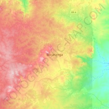
Name: Bocaranga topographic map, elevation, terrain.
Location: Bocaranga, Ouham-Pendé, Central African Republic (6.83590 15.47884 7.15590 15.79884)
Average elevation: 1,026 m
Minimum elevation: 761 m
Maximum elevation: 1,327 m
Other topographic maps
Click on a map to view its topography, its elevation and its terrain.
Bang
Central African Republic > Ouham-Pendé
Bang, Ouham-Pendé, Central African Republic
Average elevation: 607 m
Mann
Central African Republic > Ouham-Pendé > Mann
Mann, Ouham-Pendé, Central African Republic
Average elevation: 714 m