
Thank you for supporting this site ❤️
Make a donation
Make a donation
Gear up for your next adventure:
As an Amazon Associate, this site earns from qualifying purchases at no extra cost to you.
曾坑 topographic map
Click on the map to display elevation.
Thank you for supporting this site ❤️
Make a donation
Make a donation
Gear up for your next adventure:
As an Amazon Associate, this site earns from qualifying purchases at no extra cost to you.
About this map
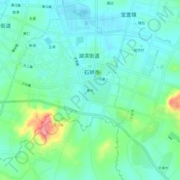
Name: 曾坑 topographic map, elevation, terrain.
Location: 曾坑, Hubin Subdistrict, Shishi City, Quanzhou, Fujian, China (24.70966 118.62354 24.74966 118.66354)
Average elevation: 27 m
Minimum elevation: 3 m
Maximum elevation: 102 m
Thank you for supporting this site ❤️
Make a donation
Make a donation
Gear up for your next adventure:
As an Amazon Associate, this site earns from qualifying purchases at no extra cost to you.