Geolocate

Vallenar topographic map

Click on the map to display elevation.

About this map

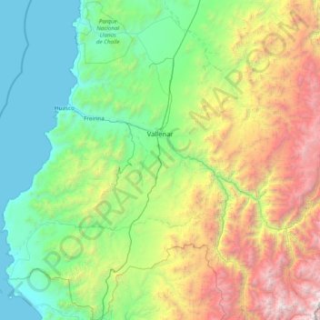
Name: Vallenar topographic map, elevation, terrain.

Location: Vallenar, Provincia de Huasco, Atacama Region, Chile (-29.35604 -71.19931 -28.00986 -70.00347)

Average elevation: 1,328 m

Minimum elevation: 0 m

Maximum elevation: 5,545 m

Gear up for your next adventure:

🥾Hiking Gaiters - Protect legs and shoes from mud, snow, and debris
🌬️Windproof Camp Stove - Efficient cooking even on exposed mountain peaks
🥾Waterproof Hiking Boots - Essential footwear for rugged terrain and wet Canadian trails
🛁Quick-Dry Microfiber Towel - Space-saving towel that dries rapidly on the move
🧢Outdoor Cap - Protective cap for sun and rain during hikes

As an Amazon Associate, this site earns from qualifying purchases at no extra cost to you.