Geolocate

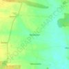
Leszno topographic map

Click on the map to display elevation.

About this map

Name: Leszno topographic map, elevation, terrain.

Location: Leszno, Greater Poland Voivodeship, Poland (51.80643 16.52380 51.88149 16.62425)

Average elevation: 97 m

Minimum elevation: 73 m

Maximum elevation: 145 m

Other topographic maps

Click on a map to view its topography, its elevation and its terrain.
Gear up for your next adventure:

🥾Hiking Gaiters - Protect legs and shoes from mud, snow, and debris
🚲Handlebar Phone Mount - View topographic-map.com live while cycling
💡Compact LED Flashlight - Powerful and portable flashlight for outdoor use
🧭Orienteering Kit - Tools for map reading and navigation in the wild
🧦Thermal Socks - Warm socks for winter hiking or camping

As an Amazon Associate, this site earns from qualifying purchases at no extra cost to you.