Geolocate

Brownfield topographic map

Click on the map to display elevation.

About this map

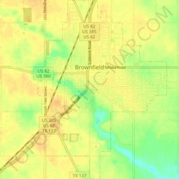
Name: Brownfield topographic map, elevation, terrain.

Location: Brownfield, Terry County, Texas, 79316, United States (33.14458 -102.29442 33.20293 -102.24408)

Average elevation: 1,009 m

Minimum elevation: 990 m

Maximum elevation: 1,019 m

Gear up for your next adventure:

🔭Outdoor Binoculars - Lightweight binoculars for birdwatching and hiking
👖Convertible Hiking Pants - Zip-off legs to adapt to changing weather conditions
🧥Waterproof Pants - Keep dry during rainy hiking conditions
🥾Lightweight Hiking Shoes - Comfortable shoes for day hikes
🧴Insect Repellent - Protect yourself from bugs during outdoor adventures

As an Amazon Associate, this site earns from qualifying purchases at no extra cost to you.