Geolocate

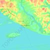
Manacapuru topographic map

Click on the map to display elevation.

About this map

Name: Manacapuru topographic map, elevation, terrain.

Location: Manacapuru, Amazonas, Região Norte, Brasil (-3.81990 -61.46418 -2.73951 -60.31550)

Average elevation: 33 m

Minimum elevation: 5 m

Maximum elevation: 116 m

Other topographic maps

Click on a map to view its topography, its elevation and its terrain.
Monte Ararate

Brasil > Amazonas > Manacapuru

Average elevation: 19 m

Manacapuru

Brasil > Amazonas > Manacapuru > Manacapuru

Average elevation: 22 m

Gear up for your next adventure:

🧥Fleece Jacket - Warm and lightweight jacket for layering
🧴Outdoor Sunscreen - High SPF protection for high-altitude UV exposure
🛁Quick-Dry Microfiber Towel - Space-saving towel that dries rapidly on the move
⛺Tent Footprint - Protect tent floor and increase durability
🥾Light Trekking Boots - Supportive boots for multi-day treks

As an Amazon Associate, this site earns from qualifying purchases at no extra cost to you.