Geolocate

Omaya topographic map

Click on the map to display elevation.

About this map

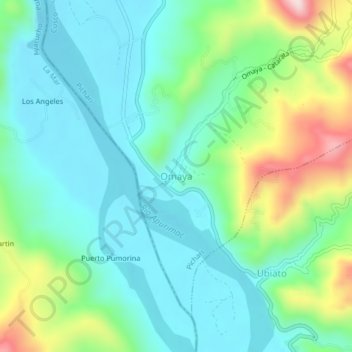
Name: Omaya topographic map, elevation, terrain.

Location: Omaya, Pichari, Province of La Convención, Cusco, Peru (-12.57926 -73.82689 -12.53926 -73.78689)

Average elevation: 646 m

Minimum elevation: 546 m

Maximum elevation: 925 m

Gear up for your next adventure:

🔨Vehicle Emergency Tool - Safety tool for remote road trips to trailheads
🛌Insulated Sleeping Pad - Critical thermal barrier between you and the cold ground
🥾Waterproof Hiking Boots - Essential footwear for rugged terrain and wet Canadian trails
🦯Trekking Poles - Reduced impact on joints for steep topographic climbs
🔭Outdoor Binoculars - Lightweight binoculars for birdwatching and hiking

As an Amazon Associate, this site earns from qualifying purchases at no extra cost to you.