Geolocate

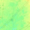
Greenwood topographic map

Click on the map to display elevation.

About this map

Name: Greenwood topographic map, elevation, terrain.

Location: Greenwood, Leflore County, Mississippi, United States (33.47161 -90.25184 33.55178 -90.14456)

Average elevation: 39 m

Minimum elevation: 32 m

Maximum elevation: 45 m

Other topographic maps

Click on a map to view its topography, its elevation and its terrain.
Gear up for your next adventure:

👟Trail Running Shoes - Agile footwear for fast-paced topographic exploration
🧳Compression Sacks - Maximize space in your backpack by shrinking gear
🧤Insulated Winter Gloves - Heavy-duty protection for sub-zero Canadian adventures
🧴Bear Spray Holster - Quick-access carry for essential Canadian wilderness safety
🔦UV Flashlight - Detect minerals or specific insects in the dark

As an Amazon Associate, this site earns from qualifying purchases at no extra cost to you.