
Pevensey Levels SSSI topographic map
Interactive map
Click on the map to display elevation.
About this map
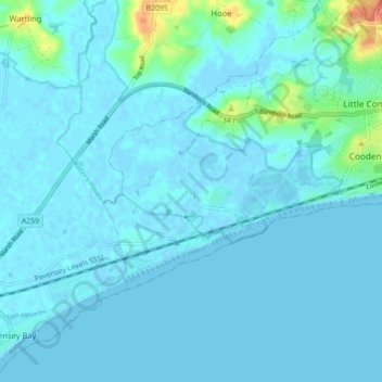
Name: Pevensey Levels SSSI topographic map, elevation, terrain.
Average elevation: 5 m
Minimum elevation: -2 m
Maximum elevation: 45 m
Other topographic maps
Click on a map to view its topography, its elevation and its terrain.
Rother
Royaume-Uni > Angleterre > Rother
Rother, East Sussex, South East, Angleterre, Royaume-Uni
Average elevation: 36 m