Geolocate

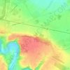
Thouars topographic map

Click on the map to display elevation.

About this map

Name: Thouars topographic map, elevation, terrain.

Location: Thouars, Bressuire, Deux-Sèvres, Nouvelle-Aquitaine, France métropolitaine, 79100, France (46.96435 -0.24053 47.00218 -0.16199)

Average elevation: 84 m

Minimum elevation: 46 m

Maximum elevation: 122 m

Other topographic maps

Click on a map to view its topography, its elevation and its terrain.

Chambre

France > Nouvelle-Aquitaine > Deux-Sèvres > Thouars

Average elevation: 92 m

Féolles

France > Nouvelle-Aquitaine > Deux-Sèvres > Thouars

Average elevation: 88 m

Rigné

France > Nouvelle-Aquitaine > Deux-Sèvres > Thouars

Average elevation: 102 m

Fontenay

France > Nouvelle-Aquitaine > Deux-Sèvres > Thouars

Average elevation: 101 m

Praillon

France > Nouvelle-Aquitaine > Deux-Sèvres > Thouars

Average elevation: 88 m

Gear up for your next adventure:

🛏️Camping Sleeping Mat - Comfortable mats for sleeping outdoors
🔭Outdoor Binoculars - Lightweight binoculars for birdwatching and hiking
🔦LED Flashlight - Powerful and long-lasting flashlight for camping and emergencies
🎒Hiking Daypack - Lightweight and durable backpacks for day trips and excursions
🧊Portable Cooler - Keep food and drinks cold during outdoor adventures

As an Amazon Associate, this site earns from qualifying purchases at no extra cost to you.