Geolocate

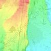
Recetto topographic map

Click on the map to display elevation.

About this map

Name: Recetto topographic map, elevation, terrain.

Location: Recetto, Novara, Piemonte, 28960, Italia (45.44271 8.39973 45.47307 8.45058)

Average elevation: 163 m

Minimum elevation: 152 m

Maximum elevation: 176 m

Other topographic maps

Click on a map to view its topography, its elevation and its terrain.

Coiromonte

Italia > Piemonte > Novara

Average elevation: 739 m

Fosseno

Italia > Piemonte > Novara

Average elevation: 548 m

Gaggiolo

Italia > Piemonte > Novara

Average elevation: 211 m

Tabarino

Italia > Piemonte > Novara

Average elevation: 555 m

Gear up for your next adventure:

🥘Camping Cookware Set - Compact nesting pots and pans for trail cooking
🦟Insect Repellent - Keep mosquitoes and black flies away in wooded areas
🧰Emergency Multi-Tool - Compact multi-tool for outdoor survival
🥾Trail Hiking Shoes - Durable shoes designed for rugged trails
⛺Camping Essentials - All-in-one gear for a comfortable camping trip

As an Amazon Associate, this site earns from qualifying purchases at no extra cost to you.